What is it like to venture to the most remote, inhabited place on Earth – Easter Island; A place where the mysterious stone moai statues hold on tight to their secrets past; A place where the ancient Rapa Nui civilization flourished and then nearly disappeared?
I wanted to find out, and of course go scuba diving while I was at it, so I arranged a whirlwind trip to Easter Island and dragged my brother Devin and his girlfriend Joanne with me. Come along on this journey as we:
- Travel around the island to see the ancient moai statues
- Hang out at the Anakena beach where the first king set foot
- Visit a volcanic crater
- Learn about legend of the Birdman
- Go scuba diving with the moai
- Take a horseback ride up to the highest point of the island
- …and eat empanadas with Mexican Elmo? – yes.
The Mysterious Rapa Nui
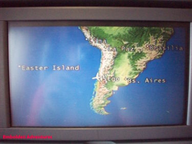
Easter Island is the most isolated, inhabited place on Earth. It is located in the middle of the South Pacific Ocean in the Southern Hemisphere as far south as Santiago, Chile. Easter Island’s closest neighbor is mainland Chile located 2180 miles to the east followed by Tahiti located 2650 miles northwest of Easter Island. Pitcairn Island is a mere 1290 miles away, but it is the least populous nation in the world comprising of just 56 people and many more seabirds.
Easter island makes up the southeastern point of the Polynesian Triangle. New Zealand is the southwestern point and Hawaii is the northern point of the triangle.
It was first called Rapa Nui by its indigenous Rapanui Polynesian inhabitants who sailed to the island around 700 to 1000 AD. At one point the Rapanui population was 15,000 strong but declined to as little as 2000 people due to deforestation, climate change, and resource scarcity.
The island became treeless, losing all 21 species of its trees – about 16 million with some standing as tall as 100 feet – and lost its entire species of land birds. The trees could not repopulate as quickly as they were removed. The lack of trees prevented the islanders from crafting new boats and it accelerated topsoil erosion causing a major decline in agriculture.
Dutch explorer Jacob Roggeveen arrived to the island on Easter Day, April 5, 1722 and gave it its name, Easter Island. Roggeveen was on a seafaring quest to locate the mythical continent of Terra Australis when he and his fleet stumbled upon the island. Later French, Spanish, and British missionaries and explorers came to the island. Then in 1888, the island became part of Chile.
In between Roggeveen’s arrival and its annexation to Chile, the Rapanui population declined drastically due to their enslavement on the South American mainland by the Peruvians and from the smallpox and tuberculosis epidemics on the island. As a consequence, the younger generations were unable to read the language or learn the culture. Therefore, not much is really known about the Rapanui history including how they arrived to the island in the first place and how and why did they construct these enigmatic moai statues.
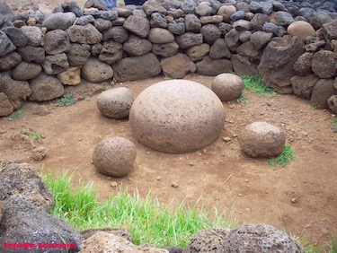
Easter Island itself is even more mysterious. It is located on one of the energy vortexes. At one of the sites on the island, a large smooth magnetic stone surrounded by 4 smaller smooth stones positioned in perfect north, south, east, west coordinates. This site is thought to be one of the axis mundi or navels of the world.
Is It Reasonable?
Nowadays, getting to Easter Island is not too difficult or very expensive despite its remoteness.
We used our airline points to purchase a flight from New York City to Santiago, Chile with a layover through Houston. That flight was roughly US$900, and it took about 15 hours in transit. Usually the flights to South America are overnight and since the destination is south, and not east or west, jet lag is not that bad. Santiago is an hour ahead from New York City.
The flight to Easter Island was about US$500 on LAN Airlines. We flew for over 5 hours on a Dreamliner jet direct from Santiago. The island is a stopover for those in South America looking to travel to Tahiti on another 6 hour flight. Flights to Easter Island depart daily during the slow season from July to September and are more frequent during the high season from December to March.
We did not have enough time to catch the morning flight out to Easter Island so we stayed 24 hours in Santiago Chile and took the flight the next day. The same goes on the way home. We would just miss the flight back to the United States, so we stayed a day in Santiago on the back end.
The airport in Santiago is about a 30 minute cab ride to the city. We spent the time exploring the city, riding the subways, and tasting the beers.
Including the tours around the island and the hotel costs, our overall trip ranged about US$2000 to $2500 per person.
Exploring Easter Island
Easter Island is a single island made up of three dormant volcanoes and lots of rolling hills. The island is about 15 miles wide and 8 miles long and can be circumnavigated by car in a day.
However, it is worth spending at least 5 days exploring the entire area.
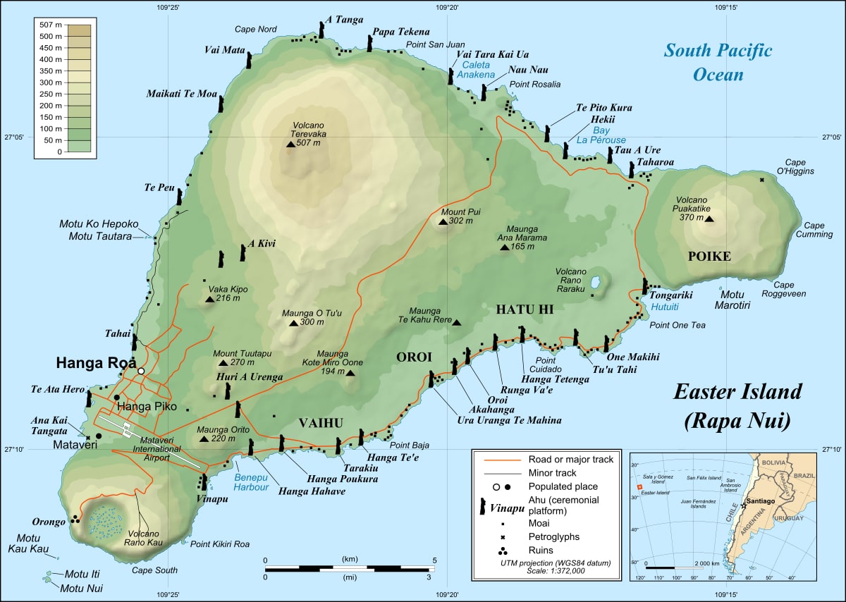
By Eric Gaba (Sting), translated by Bamse – Own work Shorelines, ponds, roads, trails and airport drawn using Landsat 7 ETM+ imagery (public domain); Topography: NASA Shuttle Radar Topography Mission (SRTM3v2) (public domain); Main references used for the toponymy: prof. William Mulloy’s map (easier to read here); Pacific Island Travel map (http://www.pacificislandtravel.com/easter_island/about_destin/isla_de_pascua[1].jpg); [1], CC BY-SA 2.5, https://commons.wikimedia.org/w/index.php?curid=2940588
![http://www.pacificislandtravel.com/easter_island/about_destin/isla_de_pascua[1].jpg](http://www.pacificislandtravel.com/easter_island/about_destin/isla_de_pascua[1].jpg)
![[1]](http://www.waymarker.co.uk/ml/rapanui/map.jpg)
Day 1
We arrived the night before from Santiago. The small airport is located in the only town on the island called Hanga Roa on the southwest point of the island. Easter Island has a population of about 6000 people, mainly living in the town. About half of the people have come from the mainland Chile to work and live while the other half are Rapanui who were born on the island.
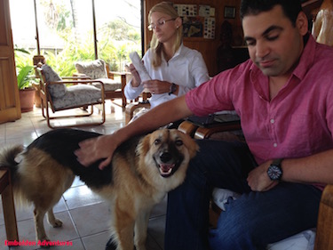
We stayed at Iorana Hotel located just a few miles from the center of town and about a five-minute drive from the airport. A local Rapanui family, who has direct ancestral ties to the last Rapanui king, owns the hotel. Our favorite dog Bodie lives on the premises and likes to tag along wherever you go.
The hotel is perched atop a cliff with panoramic sea views in the day and a vibrant starry sky, including views of the full Milky Way, the Pleiades, and the Southern Cross constellation, in the evening. We grabbed our star app on our phone to try to identify the planets and the stars. Some fishermen were out on the ocean at night with their large spotlight looking for fish. Then, I thought of how the ancient sailors navigated the long distances by sea relying on just the stars in the sky. It is amazing what early humans were able to accomplish including how they constructed these moai statues.
After breakfast, the Kia Koe tour company picked us up at the hotel in their small touring van. Our tour group was small, about 15 people or so. I booked two days of moai tours. This first full-day tour would cover:
- Akahanga
- Ahu Tongariki
- Rano Raraku
- Te Pito Kura
- Anakena Beach
We drove from the southwest part of the island to the south and then hugged the east coast of the island as we drove up to the northern part of the island. We visited different moai sites with historical significance and ended the day at the Anakena beach.
Our first stop was to Akahanga to see our first moai statues and some lava caves. The statues along the black volcanic sea cliffs were toppled. To our untrained eye, the moai and their pukao hats looked like just a pile of rocks at first until our tour guide pointed out the features.
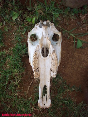
I could hear the waves lap against the coastline. Wild horses and grazing cows watched us from a distance in the grass. Horse bones and skulls were scattered on the ground. One of the dormant volcanoes was in the horizon behind the cows.
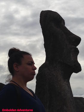
What Are The Moai?
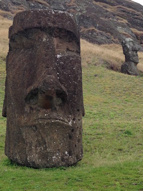
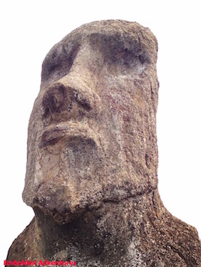
Easter Island is uniquely known to the world because of its large stone carvings called the moai. The moai are monolithic structures. Each are carved out of a single volcanic stone made into the shape of a human with large, broad noses, long ears, big lips and eyes, and pronounced chins. The moai are thought to be a symbol of reverence to spiritual leaders or chiefs on the island although noone knows for sure about the intent of these structures.
Two styles of moai are on the island: The ones that have full bodies without legs that stand tall and the ones with just a large head protruding from the hillside. The eyes once were filled with white coral and black obsidian rock to create an eyeball effect.
The moai average about 13 feet tall and weigh about 14 tons, but one has been found toppled over at 30 feet and 80 tons. Another unfinished moai at the quarry is about 70 feet in length and weighs 270 tons.
Some moai wear red volcanic stone hats called “pukao” that are cylindrical in shape, and some moai are perched up on stone platforms called “ahu”. Almost all of the moai were placed along the shores of the island with their tattooed backs facing the sea.
About 887 moai statues have been found throughout the island in clusters. Almost all of them were toppled over as a result of infighting on the island, according to historians. Most are still not repaired and re-erected.
The bodies were carved from one rock quarry on the island while the pukao hats were carved from a different rock quarry. From the quarry, the Rapanui people said that the moai “walked” to their locations around the island. Scientists have tested the theory of “walking” and concluded that the moai were pulled upright and forward with ropes tied from around the heads. The rope on one side of the was pulled to tilt the moai diagonally forward then the rope on the other side was pulled to tilt the moai diagonally forward, making the moai appear to shimmy and waddle ahead.
Next we drove along the road to Ahu Tongariki, one of the most famous Easter Island sites and a favorite for photographers looking to capture sunset and sunrise shots. On the way we had to stop to let some of the horses gallop across the road.
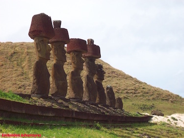
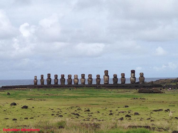
At Ahu Tongariki, 15 moais stand in a line with their backs to the scenic ocean. A moai was lying on the ground on its back and another moai stood far apart from the rest in line. One of the moai located here is the heaviest on the island, weighing 86 tons. These statues were erected again in 1990 after they were toppled due to infighting on the island centuries earlier and when a powerful tsunami hit this part of the island in 1960, washing the moai inland from their ahu platform.
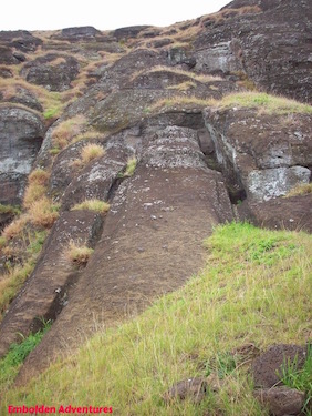
The dormant Terevaka volcano is in the distance. We headed that direction to the Rano Raraku quarry on the slope of the volcano. This moai site is significant: It is another of the most famous sites of Easter Island and a World Heritage Site.
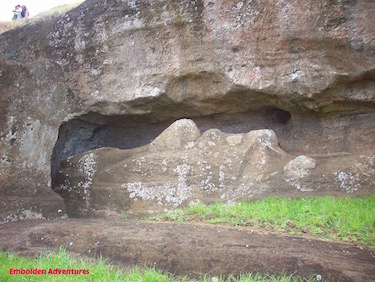
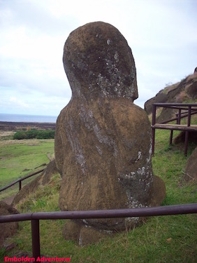
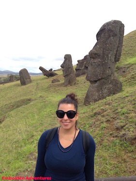
About 95% of the moais on the island were carved from this quarry, and it was in operation for over 500 years until the 18th century. Here the Rapanui people carved the moai bodies out of the rock walls, chipping away bit by bit until the head and body formed. Two unfinished moai are still visible. One that has its outline chipped out of the rock wall and a second has its long 30-foot body formed out of a flat surface rock.
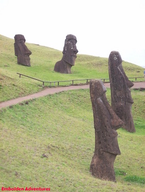
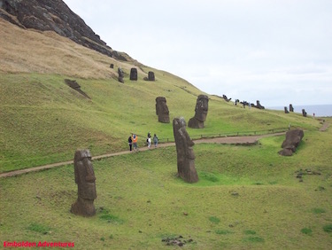
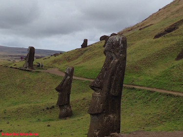
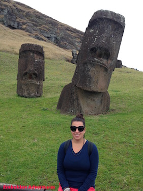
Along the hillside, large moai heads stick out from the grassland hillside. Because of the past deforestation throughout the island, the lack of tree roots have caused the soil to erode downhill, covering up the bodies of these moai. Archaeologists recently discovered that the moai bodies have been buried under the soil.
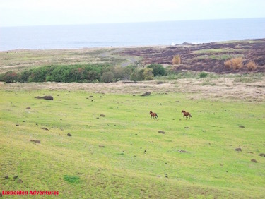
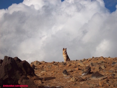
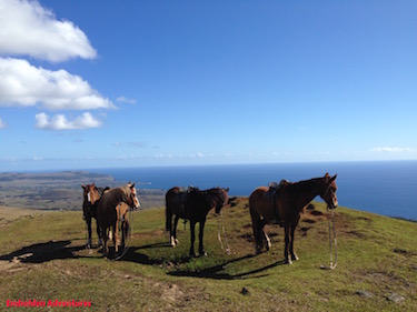
Many wild horses run free around Rano Raraku, and I captured these two running along the coast in a photo here. Up the mountain is a fresh water lake surrounded by more moai heads. The wild horses come here to drink, but some unfortunately get stuck in the mud, panic, and perish. More horse bones are strewn around this area.
Another interesting site to see is the Tukuturi moai. This one is different from the other moai in that it has a rounded head and is kneeling. This moai may be the very last one made on Easter Island.
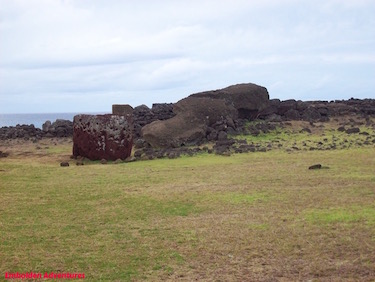
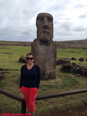
Our next stop was to Te Pito Kura along the edge of the sea. This site is significant as well. The tallest moai of the entire island is positioned here as a single moai. This moai is over 30 feet long, weighs 80 tons, and has a red pukao hat. Next to this moai is a magnetic, rounded, smooth stone thought to be the navel of the earth. Around this stone are four smaller stones each precisely aligned with the respective directional coordinates of the Earth. Not much else is known about this site.
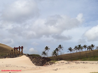
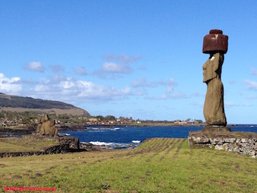
The last stop of the day was to Anakena beach. This area is significant because, as legend has it, the first Rapanui king Hotu Matu’a arrived to the island with the queen Vakai after completing his trek across the ocean from Polynesia in a canoe. It was the first time humans may have set foot onto the island.
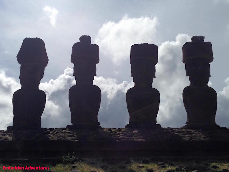
A few moai with their red pukao hats are perched up on the ahu platform with their backs to the sea. Another singular moai stands off to the side of the others.
The beach resembles a Polynesian island compared to the rest of the island that is more of a rugged, hilly, grassland terrain similar to perhaps to upstate New York. The beach has white coral sand and palm trees. The reason why this part of the island has palm trees is because they were given by Tahiti as a gift.
I enjoyed this part of the day because we got to relax in the shade, drinking cold beer and eating delicious empanadas at one of the few beachside restaurant shacks. These shrimp, tuna, or veggie empanadas were the size of calzones and made out of pastry dough. At the beach, you can swim and kayak in the roped off area. The water is very cold despite its turquoise appearance.
Day 2
The second day of our Easter Island adventure included the final full-day tour of the moai sites located on the southwest part of the island as well as a visit to the ancient religious site of the Birdman. This tour covers:
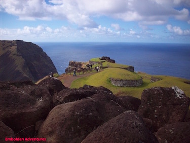
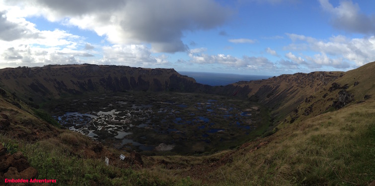
We drove up to the edge of the Rano Kau volcanic crater located at the southern tip of the island. This volcano is one of the three dormant volcanoes on the island and is 2 million years old. The crater is now a fresh water lake full of rich plant life, one of only three fresh water lakes on the island. From this vantage point, you can see gorgeous panoramic views of the ocean and of the island itself.
We had some time to hike a bit on the pathway along the crater while enduring the heavy, unrelenting, frigid winds coming from the south. The only thing separating this point and Antarctica is the Pacific Ocean ahead of us.
Around the corner to the crater is the ancient ceremonial site, Orongo. Between the edge of the crater and the steep drop off to the ocean is a small village made up of 53 sunken, circular stone huts covered in moss and sod and rocks with ancient petroglyphs. This area was reserved for the religious Birdman ceremonies.
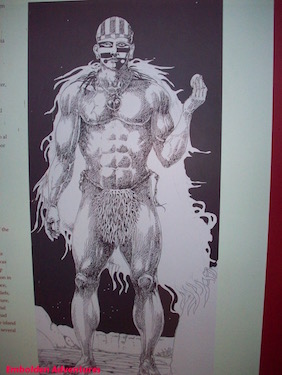
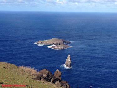
Each year in September, the sooty turn seabird migrates to the Moto Nui island rocks just off the Easter Island coast. The Rapanui men prepared for many months for this annual competition. They sought to be the one to bring back to Orongo the first laid egg from the seabird. The winner would be crowned the sacred “Tangata manu” or Birdman for the year. The Birdman would then enjoy five months of doing nothing but eating, drinking, and relaxing while letting his nails grow and wearing a headdress of human hair.
This feat was no easy measure and many men died due to drowning, shark attacks, and cliff falls. The contestants would scale down 900 feet of sharp rocks and steep cliffs to the ocean, then swim in the strong current on their surfboards to these rock islands. From there, they would climb the rocks of the island, locate the nest and egg, and then return the way they came by swimming and climbing back up the cliff, all while keeping the delicate egg intact in a reed basket attached to their head.
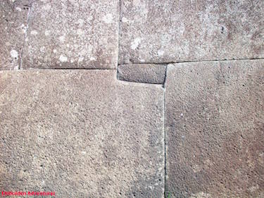
From Orongo, we headed to the Ahu Vinapu site that featured more moai including the only known female moai statue that may have had two heads and was used for cremation ceremonies.
Most of the moai here remain toppled. The best remnants of an ahu platform are at this site where the cuts of stone are exactly aligned with one another and is constructed without the use of mortar. This stonework resembles that of examples found in Machu Picchu and in the Sacred Valley in Peru, lending speculation that pre-Inca and Inca civilizations may have migrated to Easter Island as well.
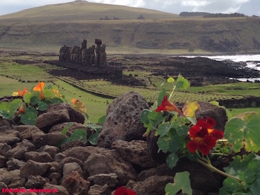
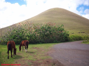
Half way through the tour, we stopped at the second rock quarry on the island. This one is Puna Pau where the red cylindrical pukao “hats” were carved. The quarry, overgrown with grass, is situated among the rolling light green hills and the trees with red flowers sort of like tiger lilies. Some of the wild horses were grazing nearby and a friendly stray dog came by to say hello. From the top of the quarry, we could see ocean views, the Hanga Roa town below, and plots of lands growing vegetables.
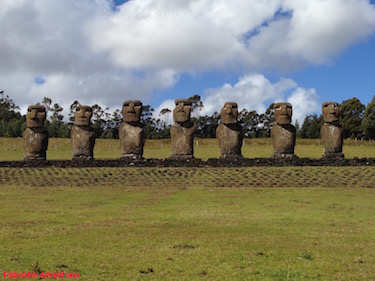
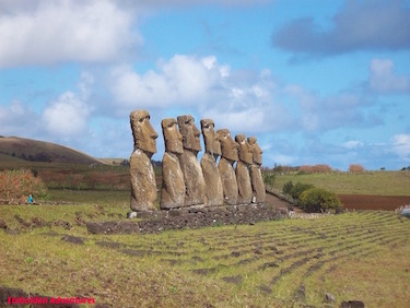
Our next stop was to the Ahu Akivi moai site among the gardens of flowering trees and farmlands. These 7 moai, each with weathered and tired facial expressions, stand perfectly aligned. They are the most unique of the moai on the island because they face the ocean. These moai have a special significance because of their celestial design. At the Spring Equinox, the sunset illuminates the faces of the moai, and at the Autumn Equinox, the the sunrise illuminates the backs of the moai.
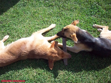
he final stop of the tour for the day was to Ahu Tahai. This site is the closest moai site to Hanga Roa, as it was first meant to be an outdoor museum to showcase the examples of the moai found across the island. Created in 1974 by American archaeologist Dr. William Mulloy, it features the Ko Te Riku moai with a pukao and restored white eyes, an example of an Orongo stone hut, and a few moai aligned on an ahu along the edge of the sea.
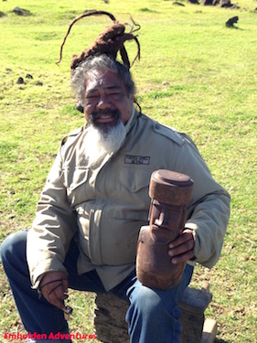
Many friendly, stray dogs run around and play at Ahu Tahai. These two were chewing on one stick together. Next to the moai, many local Rapanui artisans were selling their work including this man who carved this wood moai. I ended up buying two handmade necklaces out of seeds and materials found locally on the island. One of my necklaces is made out of a hard shell of sea urchin spikes, colored in pastel greens with hints of pink, and black seeds crafted in a traditional Rapanui style. I got it because I saw two of the local people on the plane wearing the same necklace.
Day 3
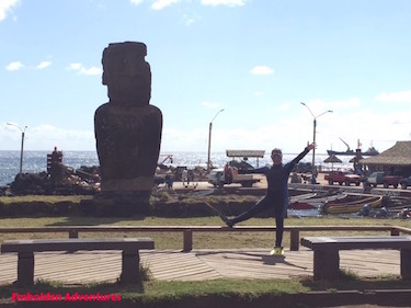
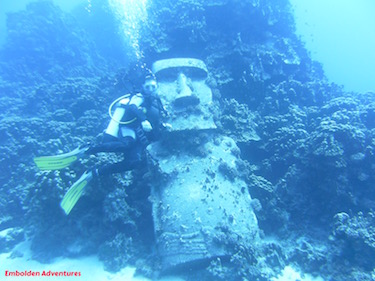
I was excited about this day because Devin and I would go scuba diving. We dove close to shore in downtown Hanga Roa next to the single stone moai along the main road. The water was a frigid 66 degrees. We wanted to see if we could dive out by the Moto Nui rock islands, but the dive shop did not have enough interested divers to join in the long ride out to sea.
We went diving with the Mike Rapu dive shop located in the heart of Hanga Roa near the local fishing boats. Mike Rapu was a famous local free diver who broke many records in his deep dives. One of the dives we did was to an underwater moai made of concrete. It was lowered into the coral reef about 10 years ago. The reef itself was an expansive blanket of beautiful hard corals but not many fish were around.
The island is heavily overfished due to illegal trawlers in the international waters. When we were there, however, the Chilean government announced in connection with the 2015 Oceans Conference that they would establish the third largest marine sanctuary in the world around Easter Island. Read more about our scuba diving experience in Easter Island here.
In between our dives, we had lunch at a local empanada shack near the elementary school. At the table we saw our new friend Lalo Garza who was on the moai tour with us on the first two days. He is the voice of Mexican Elmo of Sesame Street and does other cartoon voice work in Latin America. We had lunch together and heard all about his career and even got to hear some examples of Elmo speaking!
In the evening after diving, we checked out a bit of the downtown nightlife in Hanga Roa. The area has a bunch of restaurants serving local seafood or more diverse ethnic cuisines. This area also has souvenir shops, some tiki bars, and culture shows including the one we went to called Kari Kari.
The Kari Kari show is every Thursday night. It showcases Rapanui dancing, singing, live music, and cultural attires. The show reminded me more of Polynesian and Hawaiian culture, so it is not surprising to learn that their Rapanui language is similar to the Hawaiian language. The show was really enjoyable and even more so as we were seeking shelter under the tin roof during the torrential downpour of rain.
Day 4
We were nearing the end of this Easter Island expedition but not before we toured a bit more of downtown Hanga Roa and spent the afternoon on horseback riding up to the Terevaka volcano, the highest point of the island at over 1600 feet above sea level.
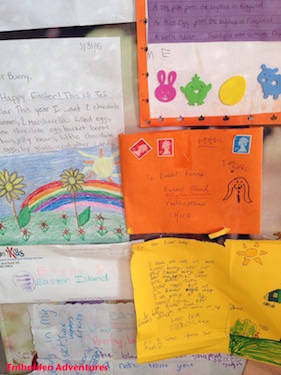
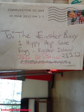
In the morning, we took a quick cab to the center of town to get our passports stamped with an Easter Island moai stamp only located here on the island. Be sure to check the times when the post office is open so you can get your stamp too.
On display were Easter cards addressed to the Easter Bunny at Hippy Hop Lane or Rainbow’s Edge from children all around the world. Of course the Easter Bunny lives on Easter Island, although we were not lucky enough to see him while we were there!
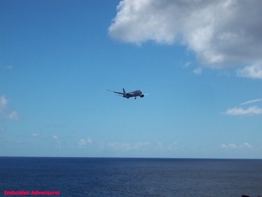
For lunch we ate at Te Moana on the outdoor patio and watched the only plane of the day land nearby at the airport. We also watched some surfers ride the waves. I was surprised to learn that Easter Island produces some top surfing talent who compete on the world’s stage.
In fact, in the afternoon, our horseback tour guide told us that she was a professional competitive surfer.
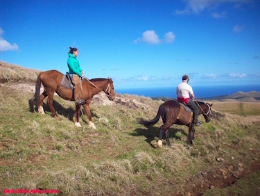
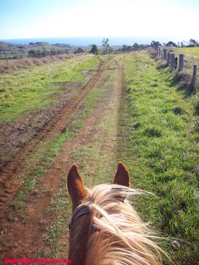
The horseback ride was just awesome. We trekked up the rolling hills of farmland, passing barking dogs and curious, grazing cows. The terrain reminded me a bit of the farmlands in Finger Lakes area of New York. I felt like I was an explorer from yesteryear riding a horse surveying an unknown land.
The island has this quiet calm to it. Many eucalyptus trees, planted in the 1960s by Australian scientists, and guavaya trees were growing all around the area. Our entire ride there was uphill and the horses worked hard to get us up to the top. Barbie was my horse.
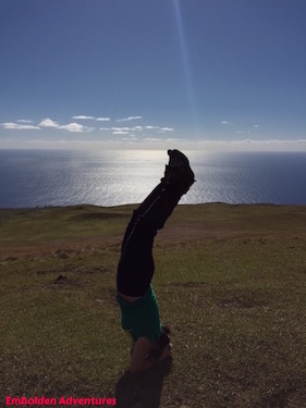
The ride roundtrip took about 3 hours or so, but it was worth the trip. From this point, we had the best 360-degree views of the entire Easter Island and as far as we could see out to the vast Pacific Ocean. It dawn on me how isolated we were in the world at this moment. I tried to look out towards the south thinking that Antarctica was not much farther away from where I was standing. The sun shone brightly and reflected beautifully off the ocean. I commemorated this experience with a yoga headstand atop the volcano.
We headed back down the trail, and it was smooth sailing for the horses who galloped all the way back. We stopped at the moai site Ahu Akivi to see it again and to part with the horses. Our guide grabbed her dirt bike – the modern day sheepdog – and led the horses back to their stables while we got a ride back to the hotel.
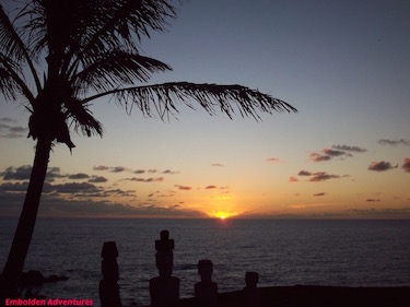
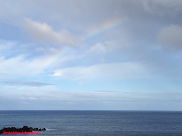
In the early evening we saw a rainbow emerge over the ocean and then watched the sun set in the horizon. It was a fitting end to our incredible trip.
Day 5
While we did not have enough time to explore the lava caves around the island or visit the Catholic church sermon on Sunday, I do recommend both activities in addition to this full slate of activities we did on this trip. The church experience blends the Catholic services with Rapanui traditions, colorful outfits, music, and singing.
Before heading to the airport for our flight back to Santiago, Chile, we said one last goodbye to our new pal Bodie the dog. He was such a happy spirit, and I’ll alway remember him when I think of Easter Island.
So go to Easter Island. It’s an easier and more cost effective trip than you may think! And share your Easter Island story here.
Until next time Adventurers